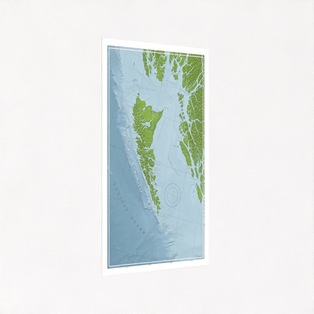
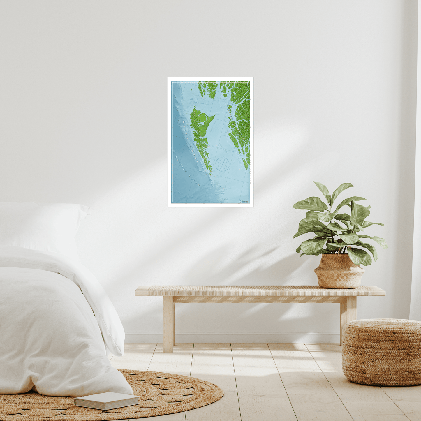
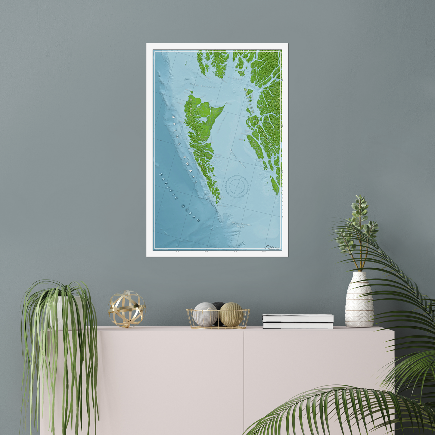
Map of Haida Gwaii
Map of Haida Gwaii
Couldn't load pickup availability
This is more than a map. It’s a portrait of the most remote, rugged, and rewarding coastline in British Columbia, Canada.
If you’re a waterperson in the Pacific Northwest (PNW), you already know: Haida Gwaii isn’t for the casual cruiser. This is a place where the swell builds fast, the charts get thin, and the safe anchorages are few and far between.
The west side? Big swell, deep water, and anchorages tucked in only 25 miles from the edge of the continental shelf. The east side? Shallow banks and sea states that shift faster than the forecast. From Cape St. James in the south, to Langara in the north-west, and Rose Spit in the north-east, every corner of these islands, including Gwaii Haanas, has a way of testing your seamanship.
If you’ve been out there, you get it. And if you haven’t yet, this map might be your call to go.
Designed for waterpeople
Most maps start with roads. This one starts with the sea. It highlights what matters to a waterperson: the key lighstations like Langara, and the places where character is built like Hecate Strait and Skidegate Bar. It shows the spots on the mainland side where you can stage to do the Hecate crossing. The map includes the towns where you fuel up, take on water, and check the weather like Sandspit, Daajing Giids, and Masset. The compass rose is pulled from a marine chart. The scale is in nautical miles.
This is a map made for sailing, surfing, fishing, kayaking, any and all ocean travel adventures. It's a practical and artful gift for Haida Gwaii ocean adventurers and anyone who has visited Gwaii Haanas.
Functional and Beautiful
30x20 inch map printed on archival-grade satin paper, this map is gallery-worthy art built to last. The details are crisp. The aesthetic is clean. The vibe? SaltyAF.
- Ocean-first design
- Gallery-quality print
- Features that matter to waterpeople
- Colours that feel like the coast
- Labels chosen with salty intent
Because you deserve more than a faded chart on the wall.
Share
Map Purpose
Map Purpose
This map is for dreaming and story-telling and is not intended for navigation.
Materials
Materials
TL;DR: 20x30 inch poster printed on nice, thick, satin (semi-gloss) photo paper.
30x20 inches (77x51 cm) premium poster. Printed with giclée techniques using fade resistant, archival inks on 240gsm, satin photo paper with a resin coating. The result is a crisp white base with vibrant colours.
Print Colour
Print Colour
Each digital screen displays colour differently so please be aware that the actual item may appear to be slightly different in color than what you see on your computer or phone screen.
Packaging
Packaging
Each print is rolled with paper to protect the print in transit. It is shipped in stout cardboard packaging, ensuring it arrives safe and secure.
Data Sources
Data Sources
Proudly made using QGIS (open-source GIS software). The stack includes SRTM hillshade and GEBCO bathymetry for a three-dimensional look. A layer of Landsat imagery to add texture to the colour ramp. Freshwater features are from the BC Freshwater Atlas.